Sunday, November 4, 2012

Route 66

We just returned from a quick trip to Tucson to get our park model ready to sell.  It wasn't a particularly exciting trip, so I had not planned to do a blog post.  But we had such a neat experience on the way back that I changed my mind.

We came back on Highway 40 through Arizona.  On previous trips we noticed signs for historic Route 66, but we had never tried it.  Since this could be our last trip, we decided to drive part of it.  We got on in Kingman. 

The road is amazing.  It's hard to imagine that this was once the main road through here.  It is two lanes, with just a gravel shoulder.  


There were many side roads, none of them paved.


 Somewhere along the way we cam across this little store and museum.


Their restroom was just a port-a potty, but it was amazingly clean.


The road became very steep and windy, with sides guarded by just flimsy wire rails.


 We were excited when we saw this sign.  We kept our eyes peeled, but we didn't see any burros.


Eventually we climbed to the summit, then started down the other side.


After a while we came upon the little town of Oatman, Arizona.  We arrived there just past noon, in time for the daily gunfight.  They block the only road through town and hope people get out and buy souvenirs and lunch while they wait.


As we waited for the show to finish, we noticed a burro on the other side of the street.  He was looking into the ice cream shop, but no one seemed to notice.


Once the gun fight was over, we got back in the car and continued out of town.  Then we spotted a bunch of burros coming up the road.  They were very tame and friendly.  We figured they did this every day.  Either they new the tourist routine, or they were released to come into town as part of the show.  In any case, we finally got to see our burros, up close and personal.


Just a little past Oatman we rejoined Highway 40.  All together we drove about 20 miles on Route 66.  It was quite an experience. 


Friday, October 19, 2012

October 9, 2012

We awoke at Redding, about two hours late.  Mt. Shasta was beautiful, as usual, in the morning sun.


We had breakfast in the dining car (our last chance to have the yummy 'Railroad French Toast!).  We had lunch in the parlor car again.  There was lots of color in the Cascades, with the bright orange vine maples and yellow big leaf maples.

We arrived in Salem at 4:15, two hours late.  After waiting about 20 minutes for a no-show taxi, we walked to the bus terminal and took the bus home.  Total miles this leg:  1,138

Total miles walked on our trip:  41.2

Total miles on the train:  7,776

We had a great time and are already thinking about our next train trip.


October 8, 2012

We awoke in Pomona about an hour late, but we arrived in Union Station in Los Angeles almost on time.  Total miles this leg:  1,995

We found some breakfast in the station while we killed a few hours.  The station is in a really lousy part of town, so we didn't feel like walking.  But the station itself is very nice.  It's been restored to its original splendor.


We left L.A. on the Starlight on time.  We had lunch in the parlor car, which was very nice.  It's available only to first class passengers. The food is similar to the dining car, but the atmosphere is nicer.  In the afternoon we attended a complimentary wine tasting there.

The early part of the trip is right along the coast.


One of the most fun things on this part of the Starlight is going up the Cuesta Grade north of San Luis Obispo.  It's a double horseshoe curve.  We can see both ends of the train as we curve around the hills.  The train climbs over 1,000 feet in 11 miles.


The trestle we cross at Stenner Creek was built on the East Coast and shipped around Cape Horn to be assembled.  Who knows why.


After climbing up the grade, we descended to the central valley.  As usual, it's acres and acres of crops.


We had a beautiful sunset in the evening. 


October 7, 2012

We awoke still in Texas, now in the desert of the west side.


Just past Del Rio, which is on the Mexican border, we crossed the Pecos River on the highest railroad bridge in the U.S.

The railroad station in El Paso was designed by Daniel Burnham, who also designed railroad stations in Washington, D.C. and Pittsburgh.  This station has been very nicely restored.


El Paso sits on the Mexican border, across from Ciudad Juarez.


Here's a different type of railroad station, this one in Sanderson, Texas.  It's on its way to being demolished.


We continued through Texas until mid-afternoon, when we entered New Mexico, then a little later, Arizona.  Things are starting to look familiar here.  Some cactus, but no saguaros.


We spent about an hour outside Tucson while two private cars were unhooked.  We are now about an hour late.  We are a little concerned because we have just a five-hour connection window to get on the Coast Starlight in L.A.

October 6, 2012

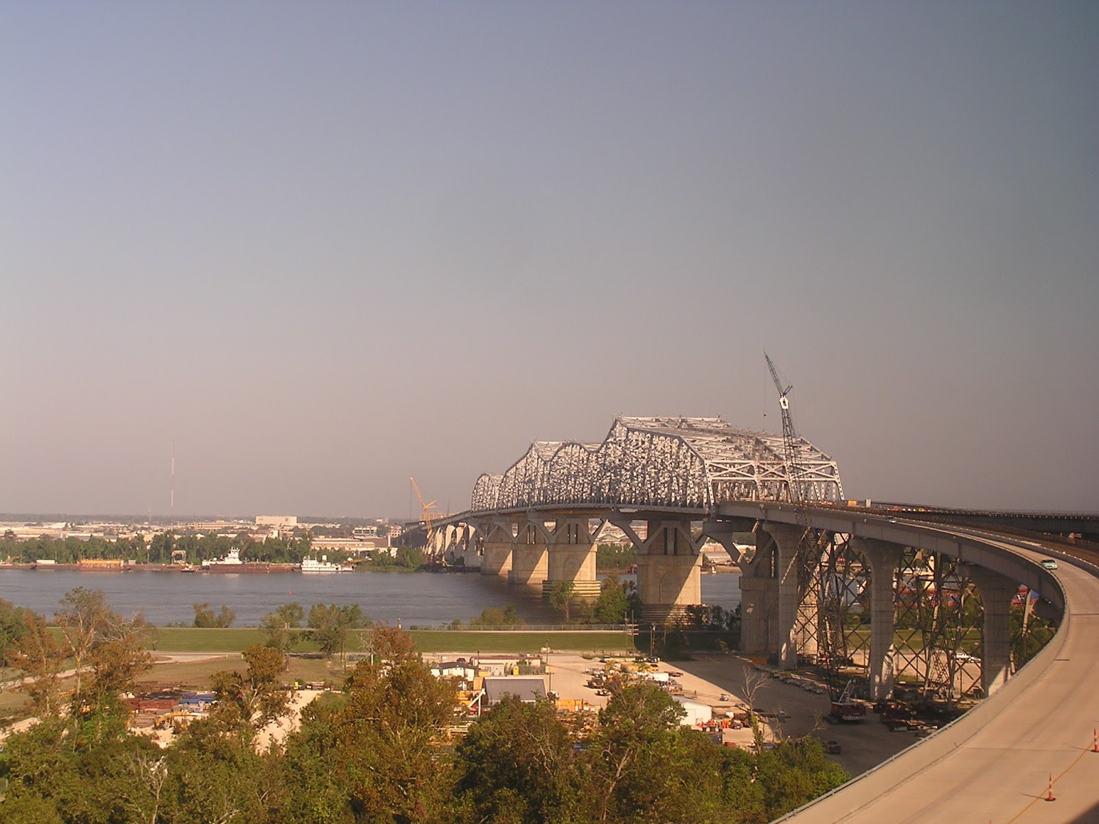
Up early today, another easy breakfast at the hotel, then a walk to the train station.  The walk wasn't long, just difficult.  This is not a pedestrian-friendly city.  The tourist areas have been fairly well maintained, but away from there the city is crumbling, along with its sidewalks.  We got on the train at 9:00 a.m. and left on time.  Soon we were crossing the Huey P. Long bridge, the longest railroad bridge in the country at 4.4 miles and 160 feet above the Mississippi River.   


We rode through miles and miles of swamps and bayous.  Lots of poverty here.

 
 The main crop here is sugar cane.


The eastern side of Texas looks very green.  Evidently they were not affected by the drought.  We were in Houston by dinner time.  In fact, we had dinner in the diner as we sat at the Houston station.

October 5, 2012

Another hot day.  After breakfast we did a walking tour of the Garden District, the neighborhood we were staying in.  We had a printout of a suggested tour, which worked out well.  This is where the Americans built their mansions when the French threw them out of the French Quarter in the 1850's.


Also in the area is Lafayette Cemetery, the oldest cemetery in New Orleans.  All the graves are above ground because it's below sea level. 


As we were walking we heard loud noises coming from the tree above us.  It turned out to be Monk Parakeets. 


After lunch we did laundry again.  Even though it was hot, we opted to do a little more walking around the neighborhood before going out for dinner.  Total miles walked today:  5.8
 

October 4, 2012

It was already hot and humid when we went to breakfast.  It was in the upper 80's the whole time we were in New Orleans, with humidity to match.  Our plan for the day had been to ride the St. Charles Avenue streetcar to the French Quarter, but the line was closed for repairs.  So we walked.


This is Preservation Hall.


After a lot of zigzagging through the streets of the French Quarter we stopped for lunch at a restaurant called Desire.  The highlight was chocolate pecan pie!

After lunch we took a tour on a carriage pulled by a mule.  We learned that all the carriages are pulled by mules because they do better in the heat than horses.  It was an entertaining tour.


 This was the mule pulling the carriage right behind us.


We then walked down to the waterfront to Cafe du Monde for have the mandatory beignets and chickory coffee.


Beignets are pretty much just square donuts without the hole, with lots of powdered sugar. When they are hot out of the fryer they are delicious.


We then walked back to the hotel and had dinner nearby.

Total miles walked today:  9.4